Open gallery
Knowing the best path can save you time. Especially in the big cities.
Using best means of public transport can increase the time you enjoy the next monument you are visiting.
 Getting guide instructions
Just tap the navigation icon on any point. You must be connected to the internet at that time. Instructions will show and you are free to move on.
Understanding and using guide instructions
Instructions are provided through Google Places. It arranges the best possible way according to the traffic and public transport options.
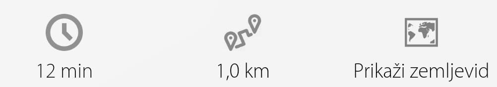 You will see:
- textual instructions with all the relevant information (numbers of busses, expected timings,...)
- aproximate time needed to get there
- distance to travel
- map icon
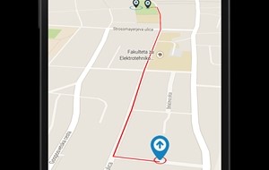
You can just simply read the instructions. Or tap the map icon and visually understand your route:
- red line for walking
- green line for transit options (bus, tram, subway)
- blue line for driving
Are there other guiding ways?
As you know, being a traveller is exciting if you get lost. So perhaps if you have time, just forget the instructions and go your own way. But always mind your safety.
Safety?
Yes, safety is very important. That's why the provided instructions are not to be followed in following cases:
- driving any vehicle; you should pay attention to driving not the mobile screen;
- danger ahead; even though the guide provides useful information it may be outdated and not relevant to your situation; please note that we cannot assure your safe journey in any way;